| |
|
| National Warnings |
| Severe Weather Discussions |
 Robert Lattery-AKA 'Vortex 100's Discussion
 |
A
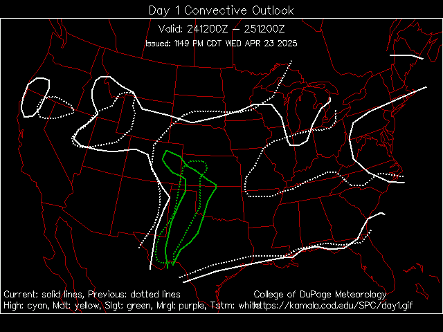
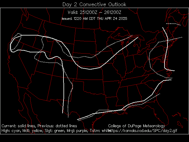
bit of information on these outlooks: A storm chaser or weather enthusiast is always interested in the possibility of severe weather near his or her area. These links are often referenced before or during storm chasing. Probably the most used outlooks are the Day 1, Day 2, and Day 3 forecasts from the Storm Prediction Center in Norman, Oklahoma. These forecasts attempt to predict the potential for supercell thunderstorms, tornadoes, damaging winds, and large hail. |
Home | General Weather | Severe Weather | Surface Weather | Upper Air | Satellite | Radar | Computer Models | Raw Data | News Articles | Tornado Pictures | Tornado Movies | FAQ'S | Research | Weather Courses | Archives | Space Weather | Storm Chasing Links | Contact | Aviation Stuff |
Disclaimer:
Storm chasing is dangerous. You could be hurt or killed in its pursuit, especially
if you have little or no knowledge of severe storms and their environment. Chase
hazards include but are not limited to heavy rain, flash flooding, lightning,
high winds, large hail, tornadoes, and flying debris. Hydroplaning on the road
and traffic accidents also occur. If you desire to chase, get informed and educated
about weather. Contact your local National Weather Service Office, and enroll
in a SKYWARN training class. Read and view all of the published information regarding
severe weather, thunderstorms, and tornadoes that you can. You are responsible
for educating yourself. Next, contact an experienced chaser in your area, and
arrange to travel with them, until you've gained sufficient experience to go
it alone. Even at that, veteran chasers get caught in harm's way from time to
time. Play it safe. This page is for informational and educational use, and the
authors disavow any responsibility for actions you may take.
Images and articles © 2009 Matthew Ver Steeg, Adam Frederick, and Weather
Edge, Inc.. All rights reserved.
Unauthorized use prohibited. Text, graphics, and HTML code are protected
by US and International Copyright Laws, and may not be copied, reprinted,
published, translated, or otherwise distributed by any means without explicit
permission.


